Geostationary Earth Images - 30/11/19
Back to Main PageI was watching one of my favourite youtubers, TheThoughtEmporium, who makes very interesting videos demonstrating radio, biology and laser prjects, and his most recent video was talking about free resources availible to anyone.
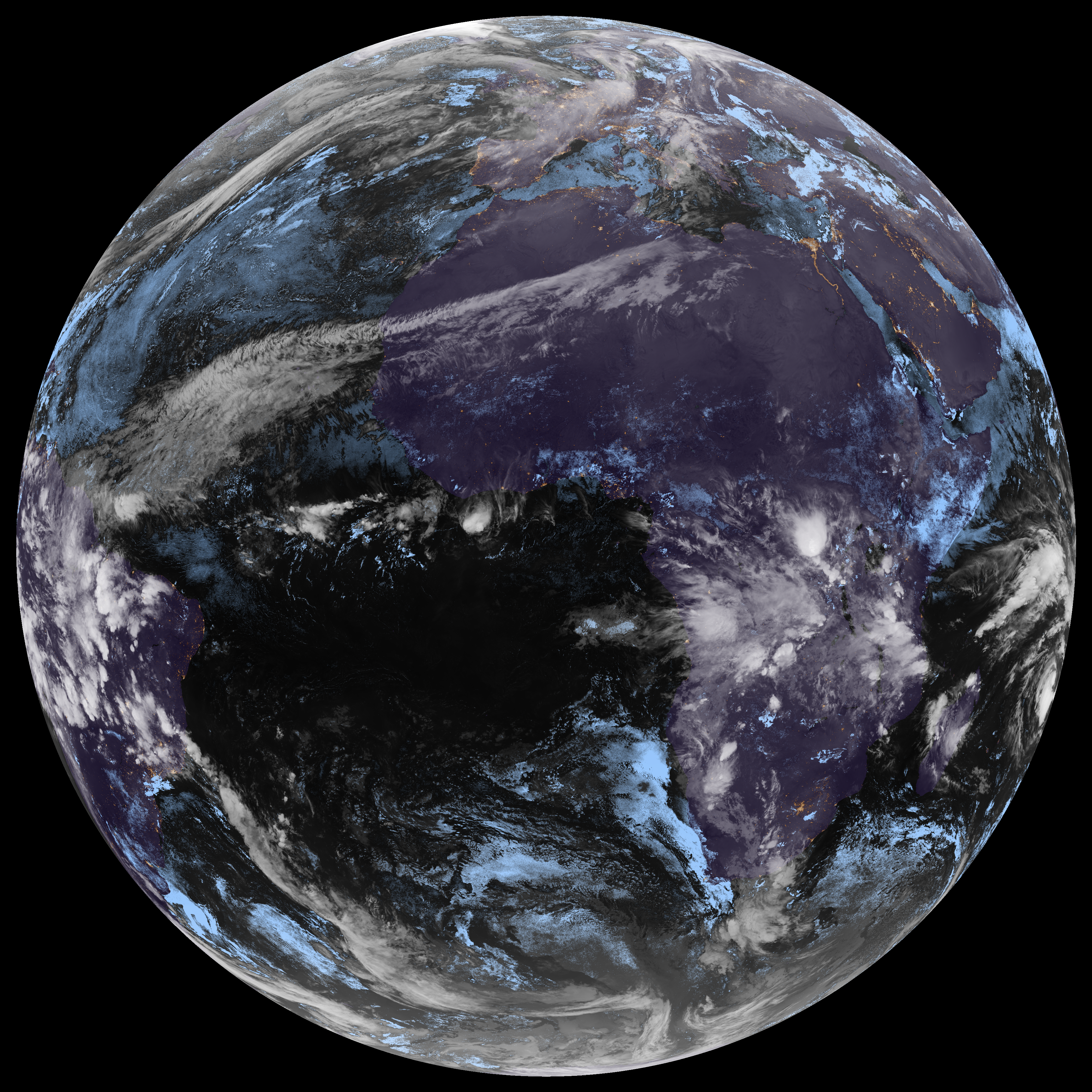
In this video, he mentions this website, which is run by CIRA, the cooperative institute for research in the atmosphere, who work closely with NOAA. This website provides easy access to the satellite images provided by 6 different satellites.
I loved how high-quality these images are, and I was already having ideas about what I could do with them. First, however, I needed to be able to download them in high resolution. After looking at the web development tools, I saw the network requests for the different zoom levels, and at that point it wasnt too hard to scrape all of the images, and re-assemble them into one large image.
I also made it resize the image to be a lot smaller, so that they are more friendly to networks. Here is the latest image that my server has (clicking on it will take you to the larger version (3712x3712)):
I have plans for what to use these images for in the future, but I haven't started work on those projects yet.
You can download the code here, and you will need PIL to run it.